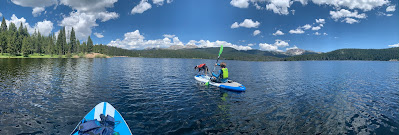
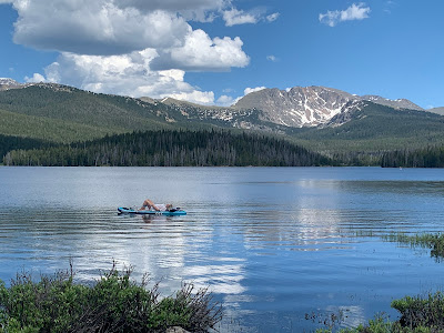
Meadow Creek Reservoir is a nice paddleboarding spot on the Fraser Valley side of Grand County. It is less known than the lakes in the Granby Area and consequently sees far fewer visitors. As an added bonus, only non-motorized boating is permitted. Its proximity to Fraser makes Meadow Creek a local favorite in the Winter Park area, but it rarely feels crowded. The sprawling forests at the Indian Peak's western foothills create a beautiful Colorado panorama that wraps around the lake.
Meadow Creek Reservoir is vehicle-accessible between June 15 and November 15, when Forest Road 129 is fully open. The approach route to the lake is more obscure than the prominent lakes on the north side of the county. The turn-off from U.S. 40, County Road 83, is 0.9 miles east of Tabernash and 2.7 miles north of Fraser. It's at the north end of the long straightaway from Fraser, just before the obvious railroad bridge. Go east on County Road 83 for 0.4 miles to a Y-ish intersection, then left on County Road 84. From this intersection onward, there is signage for the route to Meadow Creek Reservoir at every major junction. After 5.7 miles on County Road 84, go left onto forest service road 129. Continue for 2.6 miles to the Meadow Creek Dam. The reservoir is part of the Arapaho National Recreation Area and there are intermittent zones of day use fees for amenities, marked yellow on this map. Most of the logical launch points are within the fee areas so come prepared with cash for the fee station or a valid America the Beautiful Pass.
Non-motorized
Scenery: 4
Shoreline Interest: 3
Use: Moderate
Fee: $5/day
Access: Gravel
Full elev = 9980; best near full
Rec info
Rec map
Shoreline Interest: 3
Use: Moderate
Fee: $5/day
Access: Gravel
Full elev = 9980; best near full
Rec info
Rec map
Meadow Creek Reservoir is visible from Forest Road 129 as soon as the road crests over the dam. There is roadside parking just beyond the dam and this is probably the most popular launch spot on the lake. There is also a short spur to a more formal parking area with restrooms and water access just 500 feet further up the road. If visiting for the day, these two places are as good as any to put in. They will also have some of the calmest waters on the lake if there is a breeze from the prevailing westerly direction. The lake has a pleasant and scenic cove on its north shore that is particularly well protected from west and northwest winds.
The area around Meadow Creek Reservoir has some good dispersed camping sites, some of which are close to the shore. Most of the established spots are east of the lake, after Forest Road 129 loops around its north side. There is another fee area with campsites, a restroom and decent water access at 1.2 miles past the dam. Additional dispersed sites can be found 0.9 miles further. The spur roads and camping sites are not well marked, so it's a good idea to take a screenshot of an aerial map for navigation through this area if planning to camp.
Meadow Creek's shorelines are overlaid by an unusual property ownership configuration. Much of the lake and surrounding area is public federal lands. However there are several parcels of lake and shoreline that are owned by City of Englewood. Additionally, there is a parcel of private property along the lake's eastern shoreline between the two prominent inlets. Be sure to understand the property boundaries and respect private land when camping or accessing the eastern part of the lake.
 |
| Property ownership around Meadow Creek Reservoir [screenshot: Grand County GIS: https://gcgeo.maps.arcgis.com] |
Land Ownership Key
⦁ US Forest Service
⦁ City of Englewood
⦁ Private
Weather is an important consideration to take into account before committing to the trip to Meadow Creek. The lake has enough wind distance to make choppy conditions on breezy days, and it's large enough to get problematic off-shore if conditions deteriorate. Lightning is also a real possibility with afternoon storms. Check the weather overview for the probability of thunderstorms, and review the hourly forecast to understand predicted shifts in wind direction or intensity. Meadow Creek Reservoir is most attractive when it is full or near-full, Unfortunately, the USBR database does not publish water levels for Meadow Creek as it does for Lake Granby and Willow Creek. However, the frequently updated satellite imagery on sentinelhub should have sufficient resolution to tell if the lake is full-ish or not. Just be sure to set the calendar in the upper left to a recent date after linking to the sentinelhub web page.
Meadow Creek Reservoir is a great summertime excursion from the Winter Park area. It's also a great place for leisurely camping near the water. Junco Lake Trailhead is only 0.5 miles past the dispersed camping area and offers multiple hiking outings such as Caribou Pass, Columbine Lake or Satanta Peak. Any of these wilderness adventures can be complemented by a relaxing afternoon paddle on Meadow Creek. The water can be cold, so wear a PFD. Have fun and stay safe!


No comments:
Post a Comment