Guanella Pass is a familiar but charming area of Colorado's Front Range. It is relatively close to Denver, but threads between two of the loftiest massifs in the state. The heights of the Guanella Pass region hide a handful of alpine lakes. Unlike the region's forest-flanked sub-alpine lakes, like Chinns and St. Marys, the alpine zone is treeless and exposed. At least three of these alpine lakes--Silver Dollar, Square Top, and Shelf--are reasonable SUP destinations for an adventurous paddler. They all require foot travel to reach. Because of the significant effort to access these lakes, and the unceremonious nature of their settings, we weren't initially inclined to dedicate a blog post to their exploration. But after spending some placid, relaxing time here on very hot summer days, we decided that their generic splendor was precisely why we should celebrate these alpine waters.
 |
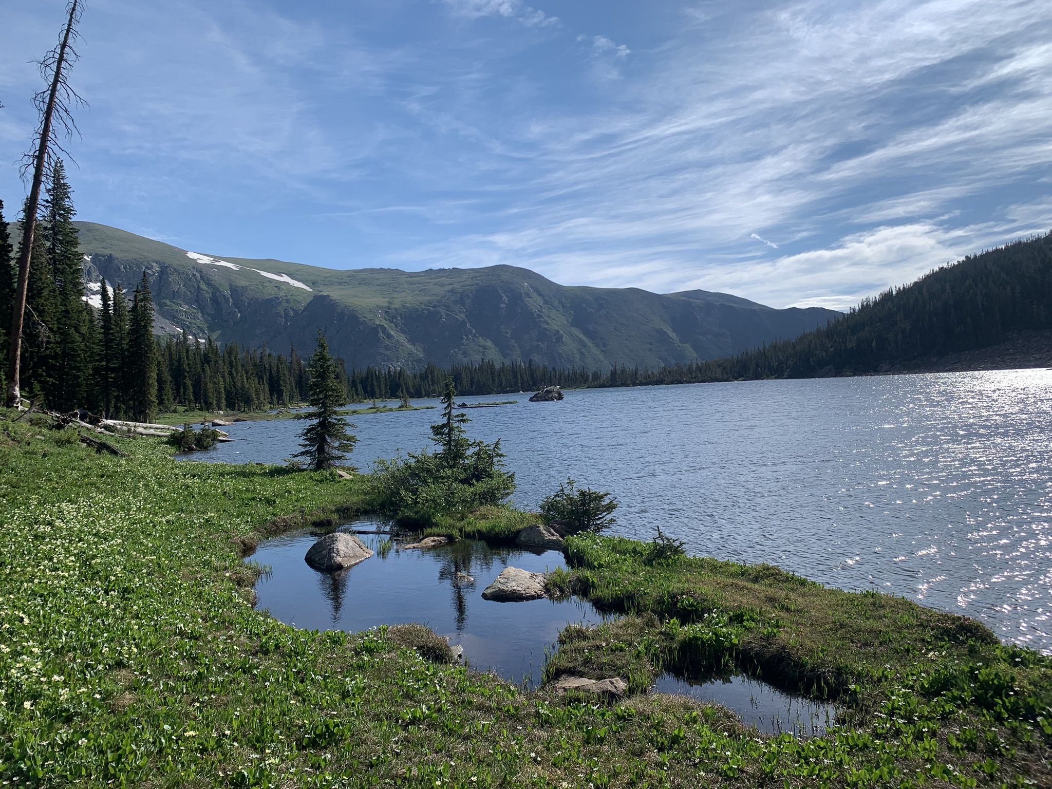
| Shelf Lake looking east; Square Top Mountain beyond |
The Guanella Pass Road traverses 24 miles between Georgetown and Grant. The Georgetown end of the road features two great paddling lakes--Georgetown Lake next to town and Clear Lake 5 miles up Guanella Pass Road. These two lakes have easily accessible by vehicle and are detailed in our Clear Lake post. Travelling south past Clear Lake, the fork spur to Silver Dollar is at mile 9 from Georgetown. The pass summit and trailhead for Square Top and Mt. Bierstadt is at mile 11. The Geneva Creek Road Junction to Shelf Lake is at mile 17. If traveling from the Denver area, Shelf Lake is a little bit shorter to approach through Grant. Both sides of the pass are easy, scenic drives.

(Silver Dollar / Square Top / Shelf)
Scenery: 3 / 3 / 4
Shoreline Interest: 1 / 1 / 2
Use: Moderate
Fee: None
Trailhead Access: Hi Clr 2WD Dirt /
Shoreline Interest: 1 / 1 / 2
Use: Moderate
Fee: None
Trailhead Access: Hi Clr 2WD Dirt /
Paved / 2WD Dirt
Hike: 1.8 mi./ 1.6 mi./ 3.4 mi.
Elev = 11950 / 12050 / 11950
Weather
Hike: 1.8 mi./ 1.6 mi./ 3.4 mi.
Elev = 11950 / 12050 / 11950
Weather