Looking for SUP places in a certain part of Colorado?

New pages for each SUP region make it more user-friendly on mobile devices!  Just tap the pull-down menu next to "Home" and go!   ...

Showing posts with label SUP. Show all posts

Sunday, August 27, 2023

Curt Gowdy State Park

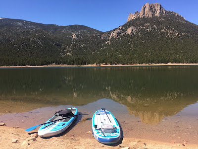
A recreational gem sits in the lumpy, rolling Laramie Range of southern Wyoming.  Curt Gowdy State Park has something for everybody: hiking, mountain biking, wildlife, boating, and even waterside camping!  The state park has become quite popular among Wyoming residents and Coloradoans exploring beyond the state's borders.  For stand-up paddleboarders, the park has three different lakes with their own personalities.  The most interesting paddling is in the lakes' inlets, which meander through the granite outcrops and mid-elevation pine forests that typify the region.  

Curt Gowdy SUP Wyoming
Granite Springs Reservoir

Even though Curt Gowdy is in a different state, it's a surprisingly quick trip from Denver.  The route to Gowdy follows Wyoming State Highway 210 (Happy Jack Road), exit 10D from Interstate 25.  The exit is about 1.5 miles past Interstate 80, and the route to the park is clearly signed from this point onward.  The main entrance to the park is about 24 miles west of Interstate 25, for a total travel time from Denver of around 2 hours (without traffic).  If you're traveling from Colorado (or any other state), the non-resident fees are $12 for day use and $32.34 for camping.  

Vicinity Map
    Location Info: [key]
    (Granite Springs / Crystal / 
        Upper North Crow)

    Scenery: 4 / 4 / 3
    Shoreline Interest: 4 / 4 / 3
    Use: Moderate / Low-moderate / Low
    Fee: $12/veh day use (non-res)
    Access: Paved/Gravel
    Full elev: 7200 / 6990 / 7500
    Rec info 
    Rec map
    Weather 


Friday, July 14, 2023

Molas Lake

Molas Lake sits placidly along one of the most vista-rich stretches of the Million Dollar Highway.  
While the famed Durango and Silverton Narrow Gauge Railroad winds through the treacherous depths of the Animas River Gorge, U.S. 550 elegantly skirts the most rugged terrain via Coal Bank and Molas Passes.  An unlikely flat near the top of the pass provides a perched setting for Molas Lake.  Two additional lakes--Little Molas and Andrews--offer more paddling options very close by.  

Paddling in the heart of the San Juan Mountains

Molas Lake
Highly visible from U.S. 550, Molas Lake is located 5 miles south of Silverton--just below the summit of Molas Pass.  The lake is actually just outside of the San Juan National Forest boundary.  It is owned by the Town of Silverton and managed as a town park, open to the general public.  The town also operates a campground on the east shores of the lake; the west side is open for day use, free of charge.  A small, lakeside store at the campground entrance also offers paddleboard and kayak rentals.  

Vicinty Map
Location Info: [key]

(Molas / Little Molas / Andrews)

Scenery: 5 / 4 / 3
Shoreline Interest: 3 / 1 / 2
Use: Mod-High / Mod-Low / Mod-Low
Fee: None for day use
Access: Gravel
Full elev = 10520 / 10920 / 10800
Rec. info 


Monday, December 6, 2021

Sweetwater Lake

Nestled in the eastern foothills of the Flattops, Sweetwater Lake is one of Colorado's lesser known gems.  Imposing cliffs flank the lake on its north and south sides, creating dramatic vistas from many perspectives around the lake.  The mid-elevation terrain, natural shoreline and wild backdrop give the Sweetwater Lake a unique personality that will surely make it a favorite among the many paddleboarding waters in Colorado.

Sweetwater Lake Colorado
Sweetwater Lake

The land around the lake recently opened up to public use after many years of private ownership.  Acquisition of the surrounding land by the Forest Service was facilitated through the Eagle Valley Land Trust to protect the area from potential private development.  In October of 2021, Sweetwater Lake became the newest addition to Colorado's collection of state parks.  This will allow recreation on and around the lake to be managed under a partnership between Colorado Parks and Wildlife and the National Forest Service.    


Location Info: [key]

    Scenery: 4
    Shoreline Interest: 2
    Use: Low-mod
    Fee: None
    Access: Gravel
    Full elev = 7709; natural
    Rec map
    Rec info 
    Weather 


Thursday, December 2, 2021

Brainard Lake

The well-loved Brainard Lake area is one of the most popular portals into the spectacular alpine terrain above Boulder.  When conditions permit, it can also be a great place to spend a half-day on the water.  The jagged skyline of the Indian Peaks make Brainard Lake a very photogenic location, especially when the water is still enough for reflections.  

Brainard Lake SUP Colorado
Brainard Lake with Indian Peaks beyond

The Brainard Lake Recreation Area is generally open for summer use between mid-June and mid-October.  Most uses require a timed-entry reservation through recreation.gov.  The area is very popular and entry windows aren't always readily available.  It's best to plan a week or more in advance or try for a weekday visit.  

Vicinity map
    Rec Area Info: [key]    

    Use: High
    Non-motorized
    Fee: $10 day use;
    Timed entry info
    Access: Paved
    Rec map
    Rec info 
    Weather 

    Lake info:
    [Brainard / Long / Red Rock]
    Scenery: 4 / 5 / 4
    Shoreline Interest: 2 / 3 / 3
    Full elev (natural): 
    10350 / 10520 / 10200 


Tuesday, November 30, 2021

Grand Teton National Park

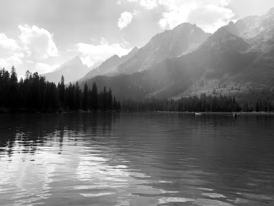
Jackson Hole is one of the world's grandest landscapes, featuring the lazily meandering Snake River contrasted against the jagged peaks of the Teton Range 7,000 vertical feet above.  Although many fine water bodies exist in the Snake River Valley, this post focuses on two that are especially inviting and quite spectacular.  Meandering String Lake is easily accessible and perfect for paddleboards in almost every way.  Neighboring Leigh Lake is a worthwhile side trip with its vast waters with epic scenery.

String Lake SUP Teton
String Lake and the Teton Range

Grand Teton is one of the nation's most popular parks, regularly hosting more than 3 million annual visits.  The park's busiest months--July and August--also feature the most accommodating stand-up-paddling conditions.  The best advice is to start early.  According to the park's website, the String Lake parking area tends to get busy around 8 am, becoming "very busy" by 10 am.  All three parking lots in the String and Leigh Lake area are clustered together and fill up around the same time.  Parking on the roads outside of the parking areas is prohibited, so it's a good idea to allow a 30 to 60 minute cushion before 8 am to be confident in finding a space.    

    Location Info: [key]
 
    Scenery: 5 
    Shoreline Interest: 
    5 (String), 4 (Leigh)
    Use: High
    Fee: $35/veh + $17/SUP
    Access: Paved
    Full elev: 
    6860 (String), 6877(Leigh); 
    minimal variation; natural
    Rec info 
    Weather 


Thursday, June 3, 2021

Lake San Cristobal

Large, natural lakes are somewhat of a rarity in Colorado.  Lake San Cristobal is one of these and it is a special place.  Located 2 miles south of Lake City, San Cristobal follows a sweeping arc along the Lake Fork of the Gunnison beneath lofty, alpine peaks.  

Lake San Cristobal
Lake San Cristobal

Lake San Cristobal makes a great destination because it is very close to the conveniences of Lake City and has plenty of other local diversions.  Five peaks over 14,000 feet reside in the surrounding mountain ranges, four of which have trail-accessible summits.  Many more peaks are slightly less lofty but far less visited.  A relaxing afternoon on San Cristobal makes a great complement to an early morning ascent of a nearby summit.  For those with a four-wheel drive vehicle, the Alpine Loop continues up the road above the lake in a spectacular circuit over Cinnamon and Engineer passes before looping back to Lake City.  There are many camping opportunities in the Lake Fork and Henson Creek drainages, as well as the developed Wupperman Campground on the lake's eastern shores.  

Vicinity Map
Location info: [key]

Scenery: 5
Shoreline Interest: 3
Use: Moderate
Fee: None for day use
Access: Gravel
Water surface elev = 9000; 
No elev change; natural
Rec info 
Weather 


Wednesday, June 2, 2021

Morrow Point Reservoir

Deep and narrow Morrow Point Reservoir is the central of the three lakes in the Curecanti National Recreation Area.  It begins immediately downstream of Blue Mesa Dam.  But unlike the highly visible Blue Mesa Lake, Morrow Point cannot be seen from U.S. 50 and is only visible from a few locations on State Highway 92--both of which run less than a mile from the lake.  The hidden nature of the lake and the moderate effort required to reach the water make Morrow Point one of the best stand-up-paddle surprises in Colorado. 

Morrow Point SUP Curecanti
Morrow Point Reservoir
Access
Accessing Morrow Point requires hiking down about 180 vertical feet from the Pine Creek Trailhead in the Curecanti Recreation Area.  The Pine Creek Trail, which is also serves guests of boat tours run by the park service, is well-constructed and consists of about 230 stairs to descend to the Gunnison River.  The flow of the river might appear fast or turbulent when it first comes into view.  The gradual transition of river flow to still lake water occurs over the next half-mile.  It will likely be necessary to hike some of all of this distance along the trail paralleling the river to find a suitable launch point.  River flows can change quickly in this stretch, and there are some protruding rocks that create whitewater conditions.  It's best to launch after the tour boat dock becomes visible to avoid surprises.  

Vicinity Map
    Location info: [key]

    Scenery: 5
    Shoreline Interest: 5
    Use: Low-Moderate
    Fee: None
    Access: Gravel + 0.5 mi, 200' vert hike down
    Full elev = 7160; Best above 7153;
    Rec info
    Rec map
    Weather


Tuesday, May 25, 2021

Green River Lakes

The Green River Lakes form the headwaters of the Green River--the same Green River that flows through Flaming Gorge, Dinosaur and Canyonlands National Park.  Lower Green River Lake with the backdrop of Squaretop Mountain forms one on the most photogenic vistas in the state of Wyoming.  Located at the northwest corner of the reclusive Wind River Range--outside of any national park boundary--the Green River Lakes are far less known and less visited than the more familiar scenes of the Tetons and Yellowstone.  From the Cirque of the Towers in the south to Titcomb Basin in the north, the 80-mile long Wind River Range features some of the most remote, wild and dramatic terrain of the lower 48 states.  The Green River Lakes are no exception.  

Green River Lakes SUP Wind River Wyoming
Lower Green River Lake with Squaretop Mountain beyond

The western flank of the Wind Rivers is home to several large, natural, glacially formed lakes--the largest of which (Fremont Lake) is 12 miles long and up to 600 feet deep.  Lower Green River Lake, significantly smaller, is better proportioned for human-powered paddle craft.  The Green River Lakes Recreation Site is 50 miles north of Pinedale, WY along mostly unpaved road.  Despite the distance, the road is in decent condition and the miles pass surprisingly smoothly.  The northern half of the road is public land and has many pleasant and scenic dispersed camping sites in the rolling meadows between the Wind River Range foothills and the meandering Green River.  There is also a forest service campground at the lake.  Bears inhabit this area, so camp responsibly.

    Location Info: [key]

    Scenery: 5
    Shoreline Interest: 2
    Use: Low-moderate
    Fee: None for day use
    Access: Gravel
    Full elev: 7975; minimal variation; natural
    Rec info
    Weather


Thursday, May 13, 2021

Rocky Mountain and Estes Park

Majestic Rocky Mountain National Park is an immensely popular tourist destination that many locals avoid during peak season.  For the 2021 season, the park is planning to a timed entry system from 5/28/2021 through 10/11/2021.  Off-season is still busy but can offer a more leisurely experience if you get a little creative with when you visit.  We recommend visiting on a weekday, even in the off-season.  

The current published policy on watercraft is buried at the bottom of the park's fishing regulations, and allows non-motorized crafts on all park waters except Bear Lake.  There are a handful of nice paddleboarding lakes in the park that are both close to a road and area not Bear Lake.  The park has specific fishing regulations for different water bodies within the park, so carefully review the fishing page if you plan to bring a rod.  A parks entrance permit ($25/daily) or annual pass is required for all waters and trails.  

Lake Estes with Lumpy Ridge beyond

Estes Park--the eastern gateway to Rocky Mountain--also features a pleasant paddleboarding destination in Lake Estes.  Lake Estes is a great backup plan for days when parking or entry to Rocky Mountain proves difficult, or when conditions higher up are less pleasant.  With a larger water surface and rentals available, it's also a great destination on its own.  Scroll to the end of the post for info on Lake Estes. 


Friday, May 7, 2021

Wellington Lake

Tranquil Wellington Lake is nestled in the rolling pine forests south of Bailey.  A well-recognized rocky peak called The Castle adds to the scenic backdrop of this inviting location.  Wellington Lake is 12 miles south of Bailey on County Road 68.  It is also quite close to the Buffalo Creek mountain bike trail network, and makes for a nice post-ride excursion after a day in the saddle. 

Wellington Lake Colorado SUP
Wellington Lake and The Castle

Starting June 2021, Wellington Lake will be implementing an online reservation-only system for summertime day use, accessed hereCamping is also available at the lake and can be reserved online as well.  However, sites may book up quickly in the summer due to the lake's popularity.  Dispersed camping is also permitted at designated sites in the Buffalo Creek mountain bike area, such as Forest Roads 550 and 554.  These areas are also popular on weekends.  

Vicinity Map
    Location info: [key]

    Scenery: 4
    Shoreline Interest: 2
    Use: Moderate-High
    Fee: $14/person
    Access: Gravel
    Full elev = 8000; Best near full
    Rec. map
    Rec. info
    Weather


Wellington Lake is privately owned and operated, but has been open to public enjoyment for decades. Considering how many private lakes are not open to public, it's refreshing that Wellington Lake continues to be shared as a recreational gem for the region. The day use and camping fees collected here help the operator to sustain its presence in our mountains.

Day Use area at Wellington Lake
Wellington Lake Colorado SUP
Wellington Lake

Paddleboard and kayak rentals are available at the lake during the summer. This makes Wellington Lake a great place to introduce family or friends to the sport as part of a larger, varied outing. A signed waiver and PFD are required for all paddling activities, whether rented or brought. Local hiking trails and a waterfall add to the diversions around the lake's perimeter.

Wellington Lake Colorado SUP
Springtime mountain backdrop at Wellington Lake

The water can be quite cold in the spring, so PFD usage is prudent. The lake also has enough wind exposure to make for choppy conditions mid-lake. If the water is cold and a breeze exists, it's always a good option to sit or kneel on the paddleboard for a lower center of gravity.  
But, as the top photo shows, conditions can just as easily be still and glassy.  Consider a wetsuit during the early season (before June) in case of an inadvertent dip, especially if still building comfort with the board.  For more information on cold water considerations, browse through the  safety page.  Have fun exploring the area, and stay safe on the water!

Please feel free to add observations of current conditions to the comments!

Saturday, April 24, 2021

Farley Canyon

Farley Canyon is one of countless side canyons on Utah's Lake Powell, but offers the perk of being vehicle-accessible with a 4X4.  In years past, Farley Canyon was a popular launch point and camping area.  The low water levels of recent years have caused the shoreline to retreat a couple of miles from the original recreation area.  At present, Farley Canyon is a separate water body from Lake Powell proper but is connected to the Colorado River by a short inflow channel.  

Farley Canyon Lake Powell SUP

Primitive camping is available at Farley Canyon, and there is a restroom at the adjacent recreation site (may be locked off-season).  As part of the Glen Canyon National Recreation Area, there is a fee of $12/night to camp here.  Camping is permitted both at the recreation area and shoreside below the high water elevation of 3700 feet.  Check regulations and fees, as they are subject to change by the National Park Service.  Quagga mussels--an aquatic invasive species--have also been present in this area.  Be sure to thoroughly clean, drain and dry any vessel or gear that has contacted the water after use.  Also ensure that no water is transported out of this lake into any other body of water.  
   
    Location Info: [key]

    Scenery: 5
    Shoreline Interest: 4
    Use: Low
    Fee: $12/day if camping
    Access: 1+ mi of 4WD 
    with sidehill section before water
    Elev at full = 3700; 
    cut-off from main lake under 3600, 
    good at any water level 
    Rec info 
    Weather 


Friday, April 23, 2021

Denver City Parks

The City and County of Denver permits hand-launched boating on five designated lakes within its parks system:
Previously, Denver Parks required a permit to launch a watercraft on these lakes.  As of 2021, permits for hand-launched vessels are no longer required.

Vicinity Map
    Location Info: [key]

    Scenery: 1
    Shoreline Interest: 1
    Use: High
    Fee: None
    Access: Paved
    Rec. info 
    Weather 


These public urban parks might not have the grandeur of Colorado's mountain lakes, but they are close and convenient for a great number of Colorado's residents.  They also inhabit charming neighborhoods with unique, eclectic shops and restaurants.  These city lakes are good options when time only allows an hour or two to get on the water.  Have fun, be safe, and support neighborhood businesses!

Please feel free to add observations of current conditions to the comments!


Thursday, April 22, 2021

McIntosh Lake

McIntosh Lake is an close, convenient stand-up paddle place for those in the Boulder County area.  Located within a Longmont neighborhood park, it enjoys a scenic backdrop of Longs Peak and Mt. Meeker.  

To minimize traffic and noise impacts for area residents, the city has implemented a 25 watercraft maximum on the lake.  If there are more than 25 vessels on the water, please return at a less busy time, or instead visit another water body.  Union Reservoir, 15 minutes to the east, is a good alternative when McIntosh is busy.  

Vicinity Map
    Location Info: [key]
    
    Scenery: 2
    Shoreline Interest: 1
    Use: High
    Fee: None
    Access: Paved
    Full elev = 5080; 
    late season drawdown possible
    Rec. info 
    Weather 


Please be respectful of the community that shares this wonderful amenity with the public by adhering the the 25 watercraft maximum.  Avoid busy times by visiting early morning, weekdays, or off-season.  In late summer and fall, the water level may drop requiring a short traverse over mud flats to access the shore.  Have fun and stay safe!

Please feel free to add observations of current conditions to the comments!

Wednesday, April 7, 2021

Southwest Utah

Located in the southwest corner of Utah, the St. George area is about as removed of a getaway that one can get from Denver while crossing only one state line.  But at about 3000 feet in elevation, the region enjoys an early spring climate more comparable to Las Vegas than the rest of Colorado and Utah.  There is also a surprising cluster of lakes in the area that maintain more moderate early season water temperatures than lakes on the Front Range.  Additionally, a large vacation rental market makes it a viable option for an early season destination from Colorado (i.e. spring break).  

Sand Hollow Lake

Multiple stand-up paddle places are featured here and they all have different personalities.  Adding recreational variety to a trip here are numerous hiking and mountain biking trails in the surrounding red-rock lands, including renowned Zion National Park and Gooseberry Mesa.  


Monday, April 5, 2021

Bear Creek & Big Soda Lakes

Conveniently located within the City of Lakewood, Big Soda Lake is possibly the worst kept stand-up paddle secret in Colorado.  High visibility, easy access, and a wake-free water contribute to its popularity.  Neighboring Bear Creek Lake allows motorized boating but offers more wooded coves and a change of scenery.  Both lakes are accessed with a day pass ($10) or annual pass ($80) to Bear Creek Lake Park.

Big Soda Lake
    Location Info: [key]
    Bear Creek & Big Soda

    Use: High
    Fee: $10/vehicle
    Access: Paved
    Rec map 
    Rec info 
    Weather 

    Bear Creek Lake[key]
    Scenery: 3
    Shoreline Interest: 3
    Full (active) elev = 5565

    Big Soda Lake: [key]
    Scenery: 2 
    Shoreline Interest: 2
    Full elev = 5700; 
    may experience late-season algae bloom


Bear Creek Lake Park can get very busy on summer weekends, and entry to the park is not assured for late morning or mid-day arrivals.  For less company, visit in the evening or on a weekday.  


Thursday, March 25, 2021

Grand Mesa

Grand Mesa is Colorado's wonderland of water.  The lush plateau at 10,000 feet of elevation features thick forests, subalpine meadows and more than a hundred lakes.  There are a handful of developed campgrounds off the main roads and many more dispersed sites in the surrounding national forest.  The vast array of lakes make for a great multi-day excursion that can be complemented with nearby hiking and mountain biking, or even with a vineyard escape to Palisade.  

Waterdog Lake; Grand Mesa

The mesa top region is traversed by the Grand Mesa Scenic Byway (State Highway 65).  Water access ranges from roadside Cobbett Lake and Island Lake (featured below) to many secluded lakes only reachable by high-clearance or four-wheel-drive.  

Vicinity Map
Location Info: [key]
(Island Lake)

Scenery: 4
Shoreline Interest: 2
Use: Low-moderate
Fee: $4 or as posted
Access: Gravel
Full elev = 10260
Rec info 
Weather 


Wednesday, March 24, 2021

Chatfield State Park

Chatfield State Park is one of the most popular spots for stand-up paddleboarding in Colorado. 
Non-motorized ponds and large wake-free areas of the main reservoir make for a variety of inviting paddling opportunities.  In addition, multiple rental sites for paddleboards, kayaks and other crafts set up within the park.  There are enough places to explore that it will take multiple trips to tour them all.  

Chatfield Gravel Pond

Chatfield's proximity to Denver makes it a convenient place for a half-day time window or a great opportunity to stretch the early or late limits of the season.  Summer weekends can be very busy.  Once the park reaches capacity, incoming vehicles will be turned back at the gates.  But if you have already made it into the park, there is plenty of water acreage for everyone.  Better yet, early mornings, weekdays, spring and fall offer the chance to avoid crowds altogether.  The  photo of solitary padding above is from a warm day in mid-November.  

Vicinity map
Location info: [key]

Scenery: 2
Shoreline Interest: 2-3
Use: High
Fee: $9/vehicle
Access: Paved
Full (active) elev = 5430; Best near full, 
late season drawdown possible;  
(scroll down to "water levels")
Rec map 
Rec info 
Weather 


Sunday, March 14, 2021

Clear Lake

Clear Lake is a compact, mountain lake above Georgetown that offers a scenic, high-country paddleboard experience a short distance from Denver.  With substantially less visibility and wind exposure than better-known Georgetown lake, it features calm waters and steep, forested shorelines.  

Clear Lake

Clear Lake is close enough to Denver to visit in a half-day from the metro area.  It also makes for a refreshing late day add-on after a hike of Mt. Bierstadt, Square Top Mtn, or other Guanella Pass area trails.  Interstate 70 traffic can be heavy on summer weekends, so check travel speeds before heading up.  Sometimes a good window can be found on Saturday afternoons when earlier recreators have already left and return traffic to Denver is lighter than on Sundays.  Late afternoon and early evening also tend to be calmer than mid-day.  

Vicinity Map
    Location Info: [key]

    Scenery: 4
    Shoreline Interest: 2
    Non-motorized
    Use: Moderate
    Fee: None
    Access: Gravel
    Full elev = 9860; 
    Best near full
    Weather


Saturday, March 13, 2021

Barr Lake

Barr Lake floats under the radar of many Denver area paddlers as compared to more popular places like Soda Lake and Chatfield.  Its appeal is calm water, moderate visitation and heavily wooded coves that create a sanctuary for wildlife.  

Barr Lake Colorado
Barr Lake

Located just outside the 470 beltway, Barr Lake is one of the closest stand-up paddle places to the Denver area.  It is especially convenient for residents of the northern or eastern parts of the metro area and those with state parks passes.  Its location in the opposite direction from the mountains and its lack of visibility from major roads help to moderate the number of visitors on busy summer days.  

Vicinity Map
    Location Info: [key]

    Scenery: 3
    Shoreline Interest: 3
    Wakeless
    Use: Moderate
    Fee: $9/vehicle
    Access: Paved
    Full elev = 5105; 
    best near full, 
    late season drawdown possible
    Rec. info 
    Rec. map
    Weather 


Wednesday, March 3, 2021

Dowdy Lake

Dowdy Lake is an absolute gem as a stand-up paddle destination.  It is non-motorized, small enough that its wind exposure is limited, but big enough to have plenty of coves, islands and outcrops to explore.  

Dowdy Lake SUP
One of many boulder outcrops in Dowdy Lake

Dowdy lake is in the Red Feather Lakes Community.  At a little under 2 hours from Denver, it may seem a bit far for a day trip but is comparable to ski day at Beaver Creek and worth the travel time.  It also offers camping right at the lake, but the reserveable sites fill up quickly once they are made available on the spring.  Despite its distance from Denver and major highways, Dowdy Lake is quite popular in the summertime and the parking areas may fill up on weekend afternoons.  Neighboring West Lake provides a nice alternative to Dowdy and sees fewer visitors.  

Vicinity Map
    Location Info: [key]
    Dowdy Lake / West Lake

    Scenery: 4 / 4
    Shoreline Interest: 5 / 3
    Dowdy - Wakeless 
    West - Non Motorized
    Use: Mod-High / Moderate
    Fees: $7/vehicle
    Access: Gravel
    Full elevs: 8150 / 8240 
    minimal variation; natural
    Rec info
    Weather