Looking for SUP places in a certain part of Colorado?

New pages for each SUP region make it more user-friendly on mobile devices!  Just tap the pull-down menu next to "Home" and go!   ...

Sunday, July 31, 2022

Twin Lakes Area

Twin Lakes is a well-recognized Colorado landmark that sits beneath the lofty Sawatch Range at the eastern gateway to Independence Pass.  A mountain backdrop of Twin Peaks and Mt. Hope makes Twin Lakes a popular subject for landscape photographers, particularly during the autumn color change.  

Twin Lakes SUP Leadville Colorado
Twin Lakes Vista

The Sawatch Range rises abruptly from the sagebrush uplands of the Arkansas Valley, through mixed conifer and aspen forests to the rocky tundra of Colorado's tallest peaks.  Mountain vistas like this are typical of the Upper Arkansas Valley, which also contains Clear Creek Reservoir and Turquoise Lake.  All three of these locations are easily accessible from U.S. 24, with only a few minutes gravel or dirt road driving from the highway.  As far as stand-up-paddle places go, the region's best attributes are the scenery, pleasant summertime temperatures, and a plethora of nearby camping and recreational opportunities.  A couple hours of paddleboard time can make a great addition to a camping, mountain biking or fourteener climbing trip in the area.  

Vicinity Map
Twin Lakes Location info: [key]
(East / Middle / West)

Scenery: 4 / 4 / 4
Shoreline Interest: 3 / 2 / 2
Use: Moderate-high / Mod. / Mod.
Fee: Varies
Access: Gravel
Full elev = 9190; water level
Rec. info: East / Middle / West
Weather 

(Scroll down for Clear Creek, Turquoise info)


Saturday, July 30, 2022

Alice's Wonderland

Are you one of the millions of travelers who have zoomed past the Alice exit on Interstate 70 west of Denver?  Have you ever pulled off the highway and ventured up Fall River Road to see what lurks up-valley?  If you follow the right paths, you will discover that many small, fantastic lakes live in the heights of this basin.  The sub-alpine tarns in this fun little pocket of Colorado delight paddleboarders, hikers and off-roaders  alike, but all have some form of effort tax.  

A gem in the wonderland

Idyllic St. Mary's Lake is not vehicle-accessible, but can be reached by a moderately steep 0.5 mile hike up the popular St. Mary's Glacier Trail.  Chinns Lake and Loch Lomond are accessed by jeep roads further down in the valley.  Each of these have their own unique wonderland features.  Both Chinns and Lomond have multiple neighbors of similar character that can be accessed by foot or 4WD vehicle.  The routes to all of these lakes generally aren't open and snow-free until mid-July.  They make a great retreat in the late summertime when temperatures on the flatlands below push triple digits.  

Vicinity Map
    Location Info: [key]
    
    (St. Marys / Chinns / Lomond)
    
    Scenery: 5 / 5 / 4 
    Shoreline Interest: 3 / 2 / 3
    Use: Moderate /  / Low-mod / Low-mod
    Fee: $5 parking / None / None
    Access: 0.6 mi. hike / 4WD / 4WD
    Full elev = 10750 / 11050 / 11200
    Weather


Friday, July 29, 2022

Tenmile Region

While Dillon Reservoir is the centerpiece of Summit County's paddleboard waters, there are more great places both downvalley (north) and upvalley (south).  This post features a few additional SUP opportunities in the Tenmile Creek area south of Frisco and Upper Blue River area south of Breckenridge.  

Clinton Gulch; Tenmile Range beyond

Two of these places--Officer's Gulch Pond and Clinton Gulch Reservoir--are ridiculously close to major highways.  A third--Lower Crystal Lake--can only be accessed by four-wheel-drive vehicle or by foot.  These places might not have the all the attributes to top the favorites list, but they're all worthwhile considerations for paddleboarding excursions in Summit County.  

Vicinity Map
    Location Info: [key]
    (Officers / Clinton / Crystal)    
    
    Scenery: 4 / 3 / 3
    Shoreline Interest: 3 / 1 / 1
    Use: Mod / Mod / Low
    Fee: None
    Access: Paved / Paved / Mod 4WD
    Full elev = 9450 / 11080 / 11980
 
    Weather:
    Officer's
    Clinton
    Crystal


Friday, July 8, 2022

Pikes Peak North Slope

South Catamount, North Catamount and Crystal Creek Reservoirs are a cluster of three scenic lakes that are readily accessible from the Colorado Springs region.  These lakes all sit around 9,200 feet in elevation on the northern flank of Pikes Peak.  Together, they comprise the North Slope Recreation Area.  

South Catamount Reservoir

The North Slope is accessed from the Pikes Peak Highway and requires a $5/adult day pass to get through the entrance gate.  Children under 16 get in for free.  A limited number of free parking passes area also available to reserve online, but these may run out on busy days.  The North Slope day passes are labeled as "fishing" passes, but are good for all permitted water activities.  Fishing is not mandatory.  The North Slope recreation passes are separate from the timed entry reservations that are required to drive the full length of the Pikes Peak Highway.  They are not valid for access to the Pikes Peak summit.  

Vicinity Map
Location info: [key]

Forested reservoirs in Pikes Peak foothills
Scenery: 3
Shoreline Interest: 3 / 4 / 2
   (North / South / Crystal)
Use: Moderate
Fee: $5/adult; day pass required
Access: Gravel
Full elev = 9200+/-; Best near full
Rec. map 
Rec. info
Weather 


Saturday, July 2, 2022

The legendary Axolotls of Lily Lake

Alright, they're not really axolotls and they're not legendary (yet), but they're still quite fascinating!  Our intrigue with these "axolotls" began at beautiful Lily Lake, just south of Estes Park.  Actually a part of Rocky Mountain National Park, Lily Lake is right next to the Peak-to-Peak with a great vista of Longs Peak, Mt. Meeker and Twin Sisters Mountain.  

The Danish cousins of Mexico's Axolotls

On a warm, mid-June paddle on Lily Lake, we noticed some small, bizarre-looking creatures swimming in the shallows of the lake only a few inches below the surface.  Then, upon paying closer attention, we realized there were hundreds--maybe thousands--of these amphibious animals within the lake.   They had four legs, a small tail, and six horn-like protrusions around their faces.  And we were baffled as to what these creatures could be.  

A beautiful June day on Lily Lake

Wednesday, June 29, 2022

What is going on with Gross Reservoir?

Paddle enthusiasts who frequent Gross Reservoir may be surprised by the road closures on the south side of the lake this year.  The closures are due to the commencement in spring 2022 of a massive project to raise the dam and expand the reservoir.  The bad news is that Osprey Point boat launch and all other south side recreational amenities are planned to remain closed through May 2027 (yes, 5 years; no typo).  The good news is that watercraft access to the lake will be maintained from the north shore, near Flagstaff Road, and from the US Forest Service land on Winiger Ridge.  

Reservoir Expansion (GIS Map: Denver Water)

To see an interactive map of current conditions and recreation impacts, scroll down or click here.

Thursday, April 21, 2022

We've expanded our SUP Places Map

More places to stand-up paddle: near and far, popular and secluded, with more to come in 2023.  View the map here!


Monday, December 6, 2021

Sweetwater Lake

Nestled in the eastern foothills of the Flattops, Sweetwater Lake is one of Colorado's lesser known gems.  Imposing cliffs flank the lake on its north and south sides, creating dramatic vistas from many perspectives around the lake.  The mid-elevation terrain, natural shoreline and wild backdrop give the Sweetwater Lake a unique personality that will surely make it a favorite among the many paddleboarding waters in Colorado.

Sweetwater Lake Colorado
Sweetwater Lake

The land around the lake recently opened up to public use after many years of private ownership.  Acquisition of the surrounding land by the Forest Service was facilitated through the Eagle Valley Land Trust to protect the area from potential private development.  In October of 2021, Sweetwater Lake became the newest addition to Colorado's collection of state parks.  This will allow recreation on and around the lake to be managed under a partnership between Colorado Parks and Wildlife and the National Forest Service.    


Location Info: [key]

    Scenery: 4
    Shoreline Interest: 2
    Use: Low-mod
    Fee: None
    Access: Gravel
    Full elev = 7709; natural
    Rec map
    Rec info 
    Weather 


Thursday, December 2, 2021

Brainard Lake

The well-loved Brainard Lake area is one of the most popular portals into the spectacular alpine terrain above Boulder.  When conditions permit, it can also be a great place to spend a half-day on the water.  The jagged skyline of the Indian Peaks make Brainard Lake a very photogenic location, especially when the water is still enough for reflections.  

Brainard Lake SUP Colorado
Brainard Lake with Indian Peaks beyond

The Brainard Lake Recreation Area is generally open for summer use between mid-June and mid-October.  Most uses require a timed-entry reservation through recreation.gov.  The area is very popular and entry windows aren't always readily available.  It's best to plan a week or more in advance or try for a weekday visit.  

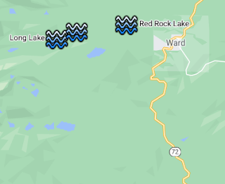
Vicinity map
    Rec Area Info: [key]    

    Use: High
    Non-motorized
    Fee: $10 day use;
    Timed entry info
    Access: Paved
    Rec map
    Rec info 
    Weather 

    Lake info:
    [Brainard / Long / Red Rock]
    Scenery: 4 / 5 / 4
    Shoreline Interest: 2 / 3 / 3
    Full elev (natural): 
    10350 / 10520 / 10200 


Tuesday, November 30, 2021

Grand Teton National Park

Jackson Hole is one of the world's grandest landscapes, featuring the lazily meandering Snake River contrasted against the jagged peaks of the Teton Range 7,000 vertical feet above.  Although many fine water bodies exist in the Snake River Valley, this post focuses on two that are especially inviting and quite spectacular.  Meandering String Lake is easily accessible and perfect for paddleboards in almost every way.  Neighboring Leigh Lake is a worthwhile side trip with its vast waters with epic scenery.

String Lake SUP Teton
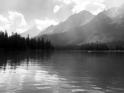
String Lake and the Teton Range

Grand Teton is one of the nation's most popular parks, regularly hosting more than 3 million annual visits.  The park's busiest months--July and August--also feature the most accommodating stand-up-paddling conditions.  The best advice is to start early.  According to the park's website, the String Lake parking area tends to get busy around 8 am, becoming "very busy" by 10 am.  All three parking lots in the String and Leigh Lake area are clustered together and fill up around the same time.  Parking on the roads outside of the parking areas is prohibited, so it's a good idea to allow a 30 to 60 minute cushion before 8 am to be confident in finding a space.    

    Location Info: [key]
 
    Scenery: 5 
    Shoreline Interest: 
    5 (String), 4 (Leigh)
    Use: High
    Fee: $35/veh + $17/SUP
    Access: Paved
    Full elev: 
    6860 (String), 6877(Leigh); 
    minimal variation; natural
    Rec info 
    Weather 


Sunday, November 28, 2021

Cliff and Wade Lakes

Hidden behind the tilting uplands of Montana's Upper Madison Valley are a pair of gem lakes that beckon with adventure.  Cliff Lake and neighboring Wade Lake are natural water bodies with pristine shorelines and teal waters, tucked between towering bluffs.  

Cliff Lake

The south end of Cliff Lake is only 5 air miles from Raynolds Pass, but the expansive topography of the Madison Valley gives scant hint of its existence.  Cliff and Wade occupy a long, meandering cleft in the otherwise rolling terrain between the Madison and Gravelly Ranges.  They are only 10 miles from the more visible Earthquake Lake, but their topographic and aquatic characteristics make them feel a world apart.

Vicinity Map
    Location Info: [key]

    Scenery: 4
    Shoreline Interest: 
    4 (Cliff), 3 (Wade)
    Use: Moderate
    Fee: None for day use
    Access: Gravel
    Full elev: 
    6300 (Cliff), 6220 (Wade); 
    minimal variation; natural
    Rec info 
    Weather 


Saturday, July 31, 2021

Southern Arkansas Valley

Home to the charming towns of Salida and Buena Vista, the Southern Arkansas Valley hides a few pleasant paddleboard lakes in its surrounding mountains.  The lakes in this area are fairly small, but they can provide great half-day on the water to complement many of the other activities in this fun area of Colorado.  Two of the lakes--Cottonwood and O'Haver--are featured below.

Cottonwood Lake

Cottonwood Lake
Cottonwood Lake is about 7 miles west of Buena Vista on County Road 306 (Cottonwood Pass Road), then 3 miles south on County Road 344.  There is a national forest picnic area (fee site) on the east side of the lake, and a free boat launch for non-motorized crafts on the west side.  There is also a campground just beyond the lake.   

Vicinity Map


    Cottonwood Lake [key]   
    Scenery: 5
    Shoreline Interest: 2
    Use: Moderate
    Fee: None for boat launch
    Access: Gravel
    Full elev = 9552; natural
    Rec. info 
    Weather 


    O'Haver Lake [key] 
    Scenery: 4
    Shoreline Interest: 1
    Use: Mod-high
    Fee: $7/veh day use
    Access: Gravel
    Full elev = 9180; natural
    Rec. info 
    Weather 


Wednesday, July 28, 2021

Earthquake Lake

Earthquake Lake is just a few miles outside of Yellowstone National Park and is one of the most fascinating landforms in the region.  The lake, which did not exist prior to 1959, formed when a strong earthquake caused a hillside collapse that dammed the Madison River.  What remains today is a narrow lake in a steep valley with hundreds of drowned trees poking out of the water.

Earthquake Lake Yellowstone
Earthquake Lake

Earthquake Lake parallels a segment of U.S. 287 just west of Hebgen Lake, about 30 minutes from West Yellowstone, MT.  The lake can be accessed from a primitive boat launch off of U.S. 287, about a half mile west of the Beaver Creek Campground.  The campground overlooks the lake, but there are no sites right at the water's edge.  The boat launch looks like it may have been the old highway that ran through the valley before the lake was formed.  This is probably the best place to put in because any roadside access further west would require scrambling down a steep embankment.

Vicinity Map
    Location Info: [key]    

    Scenery: 5
    Shoreline Interest: 4
    Use: Low-moderate
    Fee: None for day use
    Access: Paved
    Full elev: 6395; natural;
    minimal variation
    Rec. info 
    Weather 


Monday, July 26, 2021

The Sunken iPhone Treasure

As mentioned in our previous post on our favorite accessories, a waterproof phone case is one of the cheapest, yet most valuable accessories you can have.  We discovered the value of these the hard way, thanks to an act of foolishness, or carelessness, or clumsiness, or whatever you want to attribute it to... 

Gross Reservoir: vast, black, DEEP

Friday, July 23, 2021

Favorite SUP Accessories

This post does a quick tour (in no particular order) of some our favorite accessories that we've discovered for our stand-up-paddleboards.  We will likely add to this as we play around with more products!

  
As a quick note, our inflatable paddleboards are made by iRocker, so some of these specific accessories might not be compatible with every brand :(

Thursday, July 22, 2021

Eleven Mile Reservoir

Eleven Mile Reservoir is an unique stand-up paddle spot that is best characterized by the large boulders and rocky outcrops that stand over its eastern shore.  It also sees its share of wind, so check the hourly forecast before heading out.  

Eleven Mile SUP
Paddling through the enormous boulders

The reservoir is located a little more than an hour west of Colorado Springs, near the town of Lake George.  The trek from Denver--not nearly as direct--involves traveling south to the Springs then west on U.S. 24, or southwest on U.S. 285 then back east to the reservoir.  If neither of those drives sound appealing, a more scenic alternative connects Woodland Park and Pine via State Highway 67 and Jefferson County 126.  

    Location Info: [key]

    Open lakeshore with rock outcrops & boulders
    Scenery: 3
    Shoreline Interest: 5
    Use: Moderate-High
    Fee: $9/vehicle
    Access: Paved
    Full elev = 8597; Best near full 
    Water level
    Rec. map 
    Rec. info 
    Weather


Thursday, July 15, 2021

Northern Summit County

The lower Blue River basin is home to a couple of good paddleboard spots that are less than an hour downvalley from Silverthorne.  This sprawling ranchlands of the valley and rugged peaks of the Gore Range can make this area feel much further removed from the Summit ski resort towns than it really is.  

Lower Cataract Lake

Green Mountain Reservoir is the other large reservoir in Summit County.  With plenty of space and much lower visibility than the more popular Lake Dillon, it can be a quieter getaway on busy summer weekends.  Although Green Mountain is large, there are a few little nooks that are great for paddleboarding when the water level is high.  Lower Cataract Lake is only a few miles west of Green Mountain but entirely different in character.  The picturesque surroundings of the Gore Range foothills and the distant roar of the waterfall beyond put in the top tier of scenic paddleboard lakes.  


Tuesday, July 13, 2021

Piney Lake

Piney Lake is a very photogenic destination about 45 minutes north of Vail.  Mt. Powell--the highest summit of the Gore Range--and lazily named Peak C form the rugged mountain backdrop behind Piney Lake.

Piney Lake SUP Vail
Piney Lake

The shores of Piney Lake are part of the privately owned Piney River Ranch, but they are open to public access, with a $10/craft launch fee.  The ranch also rents paddleboards and canoes for $35/hr.  Piney lake is accessible starting June 21st when the access road is opened by the forest service.  The lake is accessed via Red Sandstone Road on the north side of Vail, about a mile west of the central Vail exit (176).  The route to the lake is well signed at all important junctions.  The last few miles of the dirt road have some rougher sections but can be easily navigated by most cars with slow and careful driving.  The Piney River Ranch website has more detailed information on access, parking and day use.  This is also a popular trailhead for hikers trekking up the Piney River Trail.  

Vicinity Map
    Location Info: [key]

    Scenery: 5
    Shoreline Interest: 3
    Use: Mod-High
    Fee: $10/craft
    Access: 2WD rough dirt
    Full elev = 9350; natural
    Rec map 
    Rec. info
    Weather 


Wednesday, June 16, 2021

Floating among the trees

One of the seasonal treats of the late spring is when reservoir levels rise up to and sometimes above the normal full elevation of the lake.  In some places, the high water laps back into wooded areas beyond the regular shoreline and inundates the tree trunks under a shallow depth of water.  When this happens, one can explore through the maze of trees via watercraft for a calming and unique paddleboard experience. 

Inundated cottonwoods at the south end of Chatfield Lake

There are a few places on the front range that are great for paddling through the trees when the season is right.  

Thursday, June 3, 2021

Lake San Cristobal

Large, natural lakes are somewhat of a rarity in Colorado.  Lake San Cristobal is one of these and it is a special place.  Located 2 miles south of Lake City, San Cristobal follows a sweeping arc along the Lake Fork of the Gunnison beneath lofty, alpine peaks.  

Lake San Cristobal
Lake San Cristobal

Lake San Cristobal makes a great destination because it is very close to the conveniences of Lake City and has plenty of other local diversions.  Five peaks over 14,000 feet reside in the surrounding mountain ranges, four of which have trail-accessible summits.  Many more peaks are slightly less lofty but far less visited.  A relaxing afternoon on San Cristobal makes a great complement to an early morning ascent of a nearby summit.  For those with a four-wheel drive vehicle, the Alpine Loop continues up the road above the lake in a spectacular circuit over Cinnamon and Engineer passes before looping back to Lake City.  There are many camping opportunities in the Lake Fork and Henson Creek drainages, as well as the developed Wupperman Campground on the lake's eastern shores.  

Vicinity Map
Location info: [key]

Scenery: 5
Shoreline Interest: 3
Use: Moderate
Fee: None for day use
Access: Gravel
Water surface elev = 9000; 
No elev change; natural
Rec info 
Weather