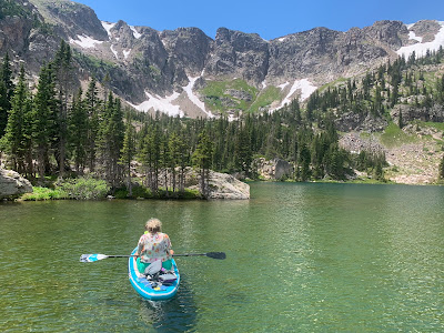
The road that ascends from the Peak-to-Peak Highway to Rollins Pass follows a century-old rail crossing over the continental divide. It is bumpy and tedious to drive, but rewards with a cluster of small paddleboarding lakes that can be easily accessed from the road. Yankee Doodle, Jenny and Upper Forest Lakes are all refreshing summertime escapes, each with their own distinct sub-alpine settings. There are scattered, primitive camping sites along Rollins Pass Road and any of these lakes make a nice addition to a car-camp outing here. The upper parts of the road usually don't melt out until July. Road status can be checked on the forest service website.
The eastern approach to the pass departs the CO-119 segment of the Peak to Peak Highway at the small town of Rollinsville. It is right where the Denver & Rio Grande West tracks cross under the highway, 2 miles south of the junction of highways 119 and 72, or 14 miles north of Blackhawk. From Rollinsville, County Road 16 (Tolland Road) travels west through the rustic community of Tolland toward the east portal of the Moffat Tunnel. At 6.5 miles from Rollinsville, just before East Portal, the Rollins Pass road turns sharply east (Forest Road 149) to begin its gently ascending path on the railroad grade up Rollins Pass. The road becomes rougher and more potholed beyond this point, but is still navigable with a moderate-clearance vehicle--it just requires slow speeds and some patience. The first Lake to appear is Yankee Doodle at 9.2 miles past the East Portal junction.
(Yankee / Jenny / Forest)
Scenery: 4 / 3 / 5
Shoreline Interest: 2 / 1 / 3
Use: Low-moderate
Fee: None
Access: High Clearance 2WD,
Fee: None
Access: High Clearance 2WD,
+ 0.3 mi. hike for Upper Forest,
4WD for Jenny Lake
Full elev = 10700-10850;
Full elev = 10700-10850;
minimal water level change
Weather
Weather


